
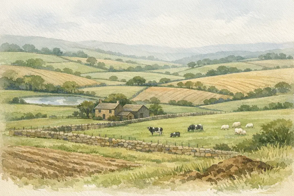
You can stand at a gate, look across a field of tidy wheat, and still be wildly wrong about its "grade". In the UK, agricultural land grade is a specific, evidence-based judgement about the land's physical limitations and how consistently it can deliver outputs, across seasons, not just on a good year.
If you're buying, renting, valuing, or trying to de-risk planning, knowing how to find agricultural land grade matters because it changes what the land can realistically do (and what someone should pay for it). This guide walks you through the practical route: start with official mapping, sanity-check it with soil and climate data, then ground-truth what you've found on site, and know when it's time to commission a formal ALC survey.
Understand What “Land Grade” Means In Practice
People use "land grade" as shorthand for three different things. That's where confusion (and expensive assumptions) creep in. Before you start hunting maps and datasets, get clear on what you actually need: a planning-grade ALC classification, a farming-focused sense of soil texture and workability, or a broader capability assessment.
Agricultural Land Classification (ALC) Grades 1–5 Explained
In England and Wales, "land grade" usually means Agricultural Land Classification (ALC). It grades land from 1 to 5, based on the land's limitations for agriculture, primarily soil, climate, and site factors.
- Grade 1: Excellent quality land with very minor limitations: highly flexible cropping.
- Grade 2: Very good quality with minor limitations: still flexible, but slightly more constrained.
- Grade 3: Good to moderate quality. This is split into:
- 3a: Better quality (part of BMV, more on that later)
- 3b: Moderate quality, more limited
- Grade 4: Poor quality: significant limitations and restricted cropping.
- Grade 5: Very poor quality: typically restricted to rough grazing or very limited use.
If you need the full context, what each grade means, why "BMV" matters, and why maps can mislead, our longer explainer on how land classification works in the UK will help you interpret what you're seeing rather than just memorising numbers.
Why Grade Drives Value, Rent, Cropping Options, And Planning Risk
Grade isn't a beauty contest: it's a proxy for reliability and flexibility.
- Value and rent: All else equal, better grades tend to command a premium because they're easier to farm consistently, support a wider range of crops, and carry less downside in awkward seasons.
- Cropping choices: Higher grades generally allow more demanding crops (and more timely operations). Lower grades can lock you into grass, forage, or lower-margin arable options.
- Planning risk: Planning policy is sensitive to losing the best land. If your parcel is BMV (Grades 1, 2, and 3a in England/Wales), you may face more scrutiny in development proposals.
One practical way to think about it: grade affects what happens in a difficult year. A field that "looks Grade 2" in a dry spring may behave like Grade 3b once you factor in wet harvests, compaction risk, and late access.
Know Which "Grade" You're Looking At: ALC Vs Soil Texture Vs Capability
You'll see three common "grading" lenses used in the UK:
- ALC (England & Wales): A formal planning-relevant classification.
- Soil texture/series (UK-wide datasets): Clay/loam/sand, depth, drainage class, organic matter, hugely useful for farming decisions, but not the same as ALC.
- Land Capability for Agriculture (Scotland): A distinct Scottish system (not ALC) focused on capability classes.
This matters because two people can be "right" while disagreeing. An investor might be quoting ALC Grade 3b from a map: a farmer might be describing heavy clay that only travels well in a narrow window: and a Scottish agent might be referencing land capability classes. Your job is to line up the right lens with your goal.
Start With Official ALC Mapping (And Its Limits)
Official mapping is the best first filter. It's fast, it's cheap (often free to view), and it gives you a starting hypothesis. But treat it like a sat-nav: useful, not gospel.
How To Find The ALC Map For England And Wales
For England and Wales, you'll often encounter ALC mapping in two broad forms:
- Published ALC maps (often smaller scale) covering wide areas
- Site-specific surveys undertaken for planning or major schemes
If you're trying to get your bearings quickly, start with an overview and then drill down. A good primer on using an agricultural land classification map helps you understand what the map can (and can't) tell you at a glance.
A practical approach when you're viewing a rural property listing or evaluating a block of land:
- Identify the exact boundary of the parcel (don't eyeball it).
- Overlay the parcel against available ALC mapping.
- Note whether the area is shown as a single grade or an association (mixed grades across one mapping unit).
How To Find The Land Capability For Agriculture Map In Scotland
In Scotland, the terminology shifts. Instead of ALC, you'll see Land Capability for Agriculture (LCA) maps and capability classes.
The big takeaway: don't try to translate Scottish capability directly into English/Welsh ALC as if they're interchangeable, they're built differently.
If you're working north of the border and want to ground your decision-making properly, it's worth reading up on agricultural land capability and how it's used in Scottish contexts.
How To Interpret Map Scale, Boundaries, And Mixed-Grade Parcels
This is where most "grade" mistakes are born.
- Scale: Small-scale maps are generalisations. They're great for regional screening, but not for valuing a 25-acre block field-by-field.
- Boundaries: ALC boundaries rarely match modern field boundaries. A single mapped unit can run straight across hedges, tracks, and drainage ditches.
- Mixed-grade parcels: It's very common for a farm or block to contain multiple grades. A valley bottom might be wetter and lower grade: a free-draining slope might be significantly better.
A simple discipline that saves a lot of grief: when you see a grade on a map, write down "mapped likely grade", not "the grade". You're still in hypothesis territory until you've checked soils, site constraints, and, where it matters, formal survey evidence.
Check Soil And Agronomic Data Sets For A More Accurate Picture
ALC mapping gives you a first pass. Soil and agronomic datasets help you test whether that pass makes sense, especially for smaller parcels, mixed land, or anywhere where local conditions (wetness, shallow profiles, salinity) can drag grade down.
Using Soilscapes And National Soil Maps To Narrow Likely Grade
UK soil datasets won't hand you an ALC grade with certainty, but they can explain why a map is showing what it shows.
When you look at soil mapping outputs, focus on:
- Texture and workability: Is it heavy clay, silty clay loam, sandy loam?
- Drainage class: Naturally wet soils can be productive in summer yet chronically limiting in spring/autumn.
- Depth to rock / restrictive layer: Shallow soils can cap rooting depth and drought resilience.
- Organic/peaty characteristics: These can be highly limiting for trafficking and can carry environmental constraints.
If you want a deeper farming-oriented lens, our guide to soil quality in agricultural land is a useful companion because it keeps the focus on practical implications: timeliness, compaction risk, rooting, and resilience.
Key Soil And Climate Factors That Typically Shift Land Up Or Down A Grade
Two parcels can sit side-by-side and still fall into different grades because ALC is heavily driven by limitations, not just yield potential.
Common factors that push land down a grade include:
- Wetness and drainage limitations: Even with good management, naturally slowly permeable layers and high groundwater can reduce workable days.
- Droughtiness: Very free-draining, shallow, or stony profiles can limit reliable yields in dry spells.
- Slope and aspect: Steeper slopes can limit machinery operations and increase erosion risk.
- Climate exposure: Upland fringe land, higher rainfall, wind exposure, and shorter growing seasons all matter.
And yes, improvement works can help (underdrainage, subsoiling, organic matter building), but ALC generally considers the land's inherent or long-term limitations, not just what you can do with a good year and a big budget.
Spot Red Flags In Data: Peat, Flood Risk, Salinity, And Shallow Profiles
If you're trying to avoid buying a problem disguised as "good land," these are the red flags worth slowing down for:
- Peat/organic soils: Can be productive but often come with trafficking limits, shrink-swell behaviour, and increasingly tight environmental scrutiny.
- Flood risk and alluvial ground: Some floodplain soils are naturally fertile: the limitation is access windows and crop loss risk.
- Salinity/coastal influence: Localised but very real in some areas, watch for yield variability and poor establishment.
- Shallow profiles over chalk/limestone/rock: Can look fine from the gate: drought stress tells a different story.
A quick, human reality check: if locals talk about a field "going late" every spring or "cutting up" at harvest, that's not gossip, it's often the lived expression of a wetness limitation that will show up in grade discussions sooner or later.
Ground-Truth The Grade: What To Look For On Site
Maps and datasets are a desk exercise. If you're putting serious money (or a long tenancy) on the line, you need to walk it. Not because you'll magically identify "Grade 2" by feel, but because you can confirm whether the likely limitations match what the data suggests.
Simple Field Checks: Profile Depth, Structure, Stoniness, And Drainage
You don't need a laboratory to spot the big signals. Take a spade, pick a few representative points (not just the easiest corner by the gate), and look for:
- Topsoil depth and consistency: A thin topsoil over subsoil/rock is a classic droughtiness flag.
- Structure: Are you seeing crumbly aggregates, or smeared/platey layers suggesting compaction?
- Stoniness: Lots of stones can reduce available water capacity and make cultivation expensive.
- Drainage indicators: Mottling (rusty/orange staining), grey colours, and a smell of stagnation can indicate periodic waterlogging.
If you're comparing two parcels, say you're weighing up whether you're looking at a strong Grade 2 vs a weaker Grade 3, this is exactly where the nuance lives. For a focused read on that boundary, see our breakdown on the difference between Grade 2 and Grade 3 land.
Access, Aspect, Frost Pockets, Exposure, And Practical Working Constraints
Grade isn't only about soil. Site limitations can be the silent killer of "good on paper" land.
Look for:
- Access and internal tracks: If you can't get on without damaging soils, your workable days shrink.
- Aspect and sun: North-facing slopes can be slower to warm and dry.
- Frost pockets: Low-lying bowls can knock spring cropping and certain horticultural uses.
- Exposure: Wind can reduce crop performance and increase spray timing challenges.
A practical tip we've seen agents and buyers miss: check where the field is wettest and coldest, not where it's easiest to stand. If the awkward corner dictates your drilling window, that corner effectively grades the whole field from an operational standpoint.
Cropping History, Yields, And Stewardship Options As Evidence
If you're viewing land as part of a purchase or rental negotiation, ask for evidence that reflects performance over time:
- Cropping history (last 5–10 years if available): rotational flexibility tells you a lot.
- Yield maps / weighbridge tickets: Not always shared, but worth asking for.
- Drainage records: Age, layout, and maintenance, especially on heavier ground.
- Environmental agreements: Stewardship options can be a positive (income resilience) but may also constrain future cropping.
If the land is marketed as top-end arable and the history shows repeated late-sown spring crops due to access, that's a signal to recalibrate your assumptions about grade, or at least about "effective grade" in wet years.
Get A Definitive Answer: Commissioning A Professional ALC Survey
Sometimes "likely Grade 3" isn't good enough. If the grade has material impact on value, planning prospects, or a dispute, you need a formal survey done to recognised methodology.
When You Need A Formal Survey (Sales, Tenancies, Planning, And Disputes)
You're most likely to need a proper ALC survey when:
- Planning is involved (especially if BMV land may be affected)
- A sale hinges on quality claims and you need defensible evidence
- A tenancy negotiation depends on land capability, cropping clauses, or rent comparables
- There's a disagreement between parties (or between mapping and reality)
In our experience, the trigger is simple: if the grade could move the number you're willing to pay, or materially change your planning risk, get it surveyed rather than arguing over screenshots of maps.
What The Survey Involves: Timing, Pit Logs, And Laboratory Tests
A competent ALC survey is structured, repeatable, and evidence-driven.
Typically it involves:
- Field inspection across the site (not just one pit in the "best" area)
- Soil pits/auger borings at appropriate density
- Horizon descriptions and logging (texture, structure, mottling, stones, depth, restrictive layers)
- Assessment of site and climatic factors (slope, exposure, flood risk context)
- Sometimes lab testing where it's warranted to clarify texture/organic content and corroborate field assessments
Timing matters. Surveys in extreme conditions (very wet or very dry periods) can complicate interpretation. A good surveyor will explain how they're accounting for conditions, and what uncertainty remains.
Costs, Timescales, And Choosing A Competent Surveyor
Costs vary with area, complexity, access, and how contentious the outcome might be. Timescales also depend on season, availability, and whether lab results are needed.
When choosing a surveyor:
- Look for relevant experience with ALC work (not just general soil sampling)
- Ask what methodology they use and how they handle mixed parcels
- Request examples of report outputs you can rely on in negotiation or planning
If you're already in acquisition mode, it's sensible to line up your wider due diligence in parallel (title, access, rights, restrictions, and so on). Our step-by-step guide on how to buy agricultural land in the UK can help you keep the rest of the process organised while the grading evidence is being firmed up.
Using Land Grade In Planning, Valuation, And Negotiation
Once you've got a credible view of grade, mapped, checked, or formally surveyed, the next step is using it properly. Grade isn't just a label: it's leverage (and sometimes a warning light) in planning, valuation, and deal terms.
Best And Most Versatile (BMV) Land: Why Grades 1, 2, And 3a Matter
In England and Wales, BMV land refers to Grades 1, 2 and 3a. It's often treated as a protected resource in planning because it's the most flexible and productive.
If your land is (or might be) BMV:
- Expect more scrutiny where development would lead to permanent loss.
- Expect buyers and valuers to care more about evidence quality (a proper survey can become disproportionately valuable).
And if you're specifically dealing with top-end land, it's worth understanding what people mean when they talk about Grade 1 agricultural land in the UK, not as a bragging right, but as a set of conditions that are rarer than many listings imply.
How Grade Interacts With Overages, Option Agreements, And Development Value
Grade can show up indirectly in legal and commercial terms, particularly where there's development hope value.
- Option agreements: If development is being explored, BMV status may affect planning strategy and probability.
- Overage (clawback): Parties might argue over whether land quality affects the "uplift" assumptions or the credibility of a planning route.
- Valuation debates: A marginal shift (say, 3a vs 3b across a meaningful area) can change the tone of negotiation, especially if the buyer's business plan relies on flexible cropping or a certain rental level.
The sensible stance: treat grade as one input into development value, not the input. Access, services, policy context, and constraints can outweigh it, but grade still influences risk.
What Lenders, Agents, And Tenants Typically Want To See
Different stakeholders look for different proof:
- Lenders often want comfort that the land's productive capacity supports the business case and that there aren't hidden constraints.
- Agents and valuers will lean on comparables but may adjust for reliability, field size, drainage, and the credibility of grade evidence.
- Tenants care about workable days, ability to carry machinery, and the real-world performance of the soil.
If you're putting together a pack for a purchase or refinance, it helps to pull the grade story into the broader narrative of the holding, cropping, drainage, access, schemes, and constraints, rather than presenting it as a standalone number.
Common Pitfalls And How To Avoid Costly Assumptions
Most grading problems don't come from bad intentions. They come from shortcuts: assuming the map is definitive, assuming the neighbour's field is identical, or ignoring how the land behaves in a difficult season.
Mistaking Neighbouring Fields' Grade For Yours
This one is incredibly common, especially where fields sit on the same "looking" soil.
But slight changes can matter:
- a buried drainage line (or lack of one)
- a thin band of heavier clay across the middle
- a perched water table in one corner
- a shallow chalk ridge you only notice in July
If you're evaluating a farm or block, walk multiple points. And if you're relying on mapped grade, check whether the mapping unit actually follows the hedges, or just cuts straight through them.
Relying On Out-Of-Date Or Small-Scale Maps Without Verification
Some published mapping is broad-brush by necessity. It's useful for screening, but it's not always suitable for pricing a specific field.
A good habit is to treat maps as triage:
- Use them to identify likely grade bands.
- Then test the assumption with soils data and on-site checks.
- Then, where the stakes justify it, commission a formal survey.
If you're going through a wider purchase decision (tenancies, rights, schemes, planning context), keep the grading work aligned with your overall due diligence. Our practical guide to agricultural land in England is built for that bigger-picture thinking, because grade rarely acts alone.
Ignoring Constraints That Reduce Effective Grade In Wet Years
This is the quietest pitfall, and one of the most expensive.
A field can look brilliant in a kind spring and still be a problem when:
- harvest turns wet and you can't travel without damage
- late autumn drilling becomes impossible
- compaction builds because you're working in narrow windows
- gateways and access tracks become the choke point
When you're trying to "find agricultural land grade" for real decision-making, ask yourself: what's the limiting season here? The grade conversation should reflect the worst realistic constraint, not the best-case week when you visited.
Conclusion
Finding agricultural land grade in the UK is less about hunting for a single perfect map and more about building a chain of evidence. Start with official mapping, interrogate it with soil and climate datasets, and then validate what it means on the ground, because workable days, drainage reality, and site constraints decide how the land performs when conditions turn.
If you're at the point where grade could change the price, the rent, or the planning route, don't leave it to inference. Get a professional ALC survey and make sure the rest of your due diligence is just as disciplined.
Disclaimer: AgLand.co.uk is a UK agricultural land and rural property matching service, where buyers register what they are looking for and owners advertise directly to the buyers who match, and a rural resource hub. Nothing in this text is intended as legal, financial, tax, or investment advice. You should carry out your own due diligence and seek advice from suitably qualified professionals (for example, a chartered surveyor, agricultural valuer, solicitor, tax adviser, or planning consultant) before making decisions.