
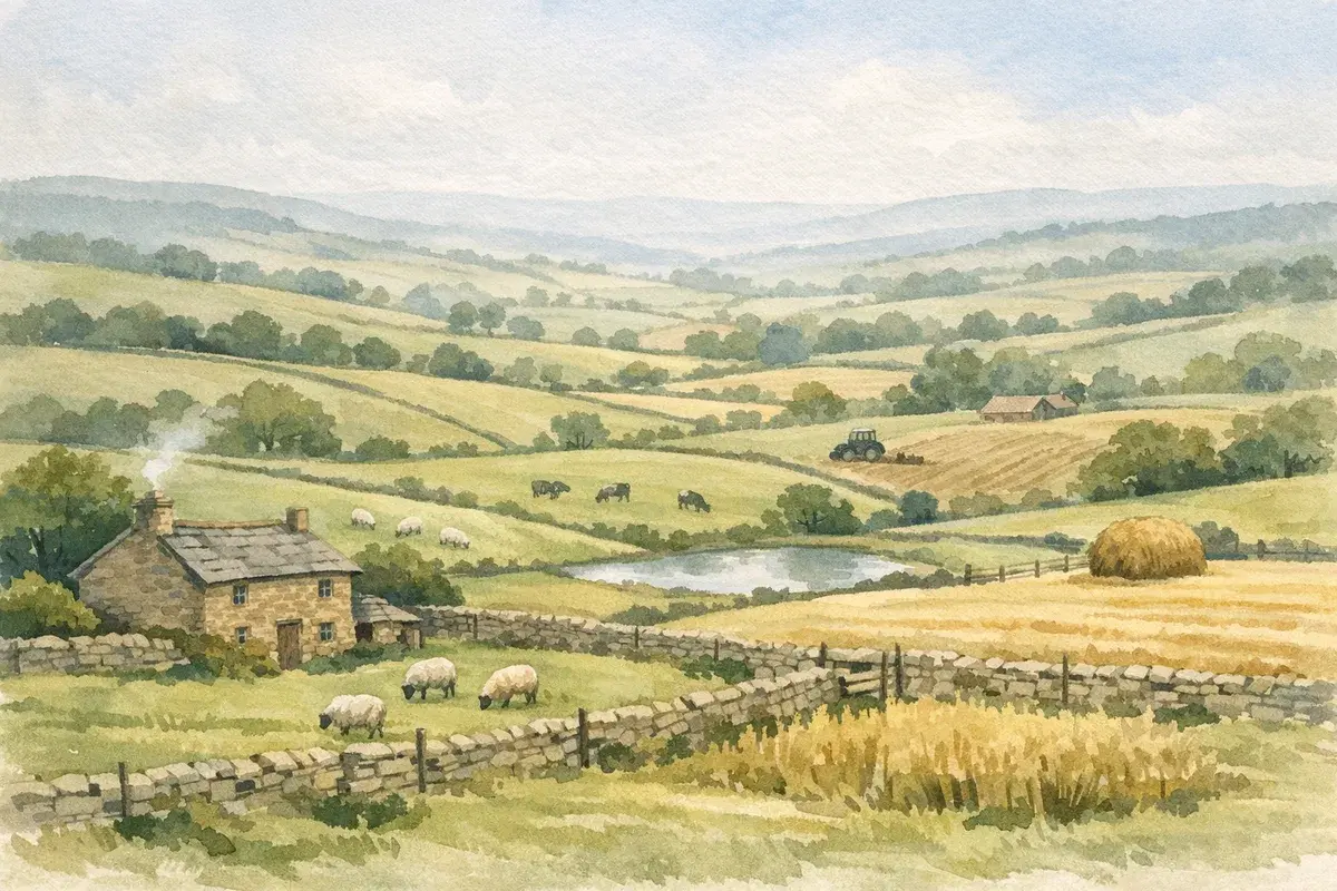
You can stand at a gate, look across 80 acres, and still not know what you're really buying (or letting). One field grows wheat like it's on rails: the next one, on paper "similar", cuts up every October and never quite hits its yield potential. That gap, between what land looks like and what it can reliably do, is exactly what agricultural land capability is about.
In the UK, capability sits at the crossroads of soils, climate, water, slope, access, and constraints you only feel once you're running machinery, moving stock, or trying to push a cropping rotation through a wet spring. Get capability right and you're pricing, financing, and planning from solid ground. Get it wrong and you're paying Grade 1 money for Grade 4 performance, or inheriting a "simple" diversification idea that's kneecapped by access, designations, or drainage.
This guide walks you through how to assess a holding's true potential, practically, field-by-field, and with the kind of caution you need when the sums are big and the margins can be thin.
What Agricultural Land Capability Means (And Why It Matters)
Agricultural land capability is the land's inherent capacity to support agricultural use, reliably, economically, and over time, given its physical characteristics and local climate. It's about what the land can do before you throw clever management (or big capital spend) at it.
Capability matters because it's the quiet driver behind:
- Cropping and grazing reliability (can you get on when you need to?)
- Yield potential and quality (and how variable it is across a holding)
- Cost base (extra cultivations, re-drilling, forage bought-in, repairs)
- Resilience (how badly a wet year, or a dry one, punishes you)
- Value (sale price, rent, and lender confidence)
Capability Vs Suitability Vs Land Classification
People often bundle these together, but they're not the same thing:
- Capability: what the land can inherently support (soil, climate, slope, water, constraints). Think "ceiling".
- Suitability: what it's suitable for in your context, your system, kit, labour, rotation, local markets, and risk appetite. Think "best fit".
- Land classification: a formal framework used by planners and valuers to describe land quality (for example, ALC grades in England/Wales or LCA classes in Scotland). Think "shared language".
In England and Wales, capability conversations often orbit around ALC and planning implications, particularly where Best and Most Versatile (BMV) land is involved. If you want a clean grounding in those grades and what they really mean in practice, see our explainer on how land grades are used in the UK.
Where It Shows Up In Real Decisions (Buying, Letting, Diversifying, Lending)
Capability isn't academic. It shows up in the decisions where mistakes are expensive:
- Buying: You're not just buying acres, you're buying workable days, trafficability, and yield stability.
- Letting / contract farming: Capability influences what a tenant can realistically deliver and what rent is defensible.
- Diversifying: A "simple" yard conversion can be undone by flood risk, access, or designations. A premium horticulture plan may fail on water.
- Lending and valuations: Lenders and valuers care about productive potential and risks. If two holdings have the same area but one has reliable soils and access, it often gets better terms and stronger interest.
Capability is also a negotiation tool. If you can evidence constraints, wetness, slope, access pinch points, you can price and plan with less guesswork.
The Main Factors That Determine Land Capability
If you want a practical way to think about capability, treat it as a stack of limiting factors. The "weakest link" often sets the ceiling, especially in a wet UK autumn or a dry eastern summer.
Climate And Growing Season
In the UK, climate isn't just rainfall totals, it's when it falls and how that interacts with soils.
Key capability questions:
- Length of growing season: Are you routinely constrained on harvest and autumn drilling? Or do you reliably get an early spring start?
- Rainfall pattern and intensity: Heavy bursts can overwhelm drainage even on decent soils.
- Frost risk and exposure: Higher, more exposed land can narrow cropping options and increase stock management costs.
- Drought risk (increasingly relevant in parts of East Anglia, the South East, and lighter soils): It can cap yield and make certain enterprises water-limited.
Soils: Texture, Depth, Drainage, Stoniness, Organic Matter, Compaction
Soils are usually the biggest determinant of capability because they control trafficability, rooting, nutrient cycling, and water availability.
You're looking at:
- Texture (sand/silt/clay balance): Heavy clays can be highly productive but unforgiving on timing: light sands are workable but can be drought-prone.
- Depth and rooting zone: Shallow soils over rock, gravel, or compacted layers can cap yield and resilience.
- Drainage: Natural drainage plus artificial drainage condition. A field that "ought" to drain but doesn't often points to blocked outfalls, collapsed pipes, or compaction.
- Stoniness: Machinery wear, crop establishment issues, and limitations for veg/horticulture.
- Organic matter: Influences structure, water holding, and workability.
- Compaction: One of the most common hidden constraints, especially where maize, late lifting, or heavy kit has been used in marginal conditions.
Soil quality deserves its own deep dive because it's where paper capability and real-life performance most often diverge. We've put a practical guide to what to look for, without turning you into a lab, here: how soil condition affects land performance.
Topography: Slope, Aspect, Altitude, Exposure
Topography affects capability in ways buyers underestimate until the first season:
- Slope: Not just "can you get a tractor on it?", but can you operate safely and efficiently, and can you avoid erosion and run-off?
- Aspect: South-facing slopes warm earlier and dry quicker: north-facing land can hold moisture and stay cold.
- Altitude/exposure: A few extra weeks of winter and wind can make a big difference to grass growth, lambing/calving conditions, and cropping reliability.
Water: Availability, Flood Risk, Irrigation Constraints
Water is a two-sided constraint: too much (flooding/waterlogging) or too little (drought/irrigation limits).
Assess:
- Water supply reliability: Mains, boreholes, abstraction, storage. If you're thinking horticulture, water is often the deal-breaker.
- Flood risk: River floodplains, surface water ponding, and how quickly land "comes back" after an event.
- Irrigation practicality: Even if you have water, can you move it around? Are there power constraints? Do fields suit reels or booms?
Access, Field Size, Boundaries, And In-Field Constraints
A holding can have great soils and still be operationally awkward.
Look for:
- Access points: Gate width, sight lines, road class, turning space.
- Field size/shape: Small, irregular fields increase time and costs: they can still work well for grazing, horses, or specialist cropping, but you need to price that reality.
- Boundaries: Hedges, ditches, banks, great for biodiversity and shelter, but they influence workable area and manoeuvrability.
- In-field constraints: Pylons, poles, wet corners, springs, public rights of way, and historic landfill/infilling.
Capability isn't one number. It's a pattern across the farm, and access and layout often explain why two "similar" soil types deliver very different margins.
UK Frameworks And Datasets You’ll Encounter
UK land capability conversations are shaped by different national frameworks and, crucially, by how planning and valuation use them. The trick is knowing what each dataset can tell you, and what it can't.
Agricultural Land Classification (ALC) In England And Wales
In England and Wales, the Agricultural Land Classification (ALC), maintained by Natural England, grades land from 1 (excellent) to 5 (very poor), based on physical limitations including climate, site factors, and soil characteristics. The headline planning term you'll see is Best and Most Versatile (BMV) land: Grades 1, 2, and 3a.
Two practical points that matter in real transactions:
- Grade isn't uniform across a holding. A 200-acre farm can include pockets of 2, 3a, 3b and 4, especially where soils change over short distances.
- "Grade 3" is not one thing. The split between 3a and 3b is a big deal in planning and in how people perceive value.
If you're specifically trying to understand what top-end land looks like in practice (and what it's worth paying for), our guide to what makes top-grade land different is a useful reference point.
Land Capability For Agriculture (LCA) In Scotland
Scotland uses the Land Capability for Agriculture (LCA) system, which classifies land based on the range of crops that can be grown and the degree of limitation from climate, soils, and slope.
In plain terms, LCA is often more directly "capability-shaped" than the way ALC gets discussed in England and Wales, because it emphasises practical cropping limitations and the reliability of agricultural use.
If you're looking at Scottish land, it's worth paying close attention to:
- Climate constraints (altitude/exposure can dominate)
- Workability and wetness
- The line between land that's realistically arable versus rotational grass versus permanent grass
How To Use Public Mapping Without Over-Trusting It
Public datasets are brilliant for a first pass, but they're not a substitute for field observation.
A few grounded rules:
- Use maps to ask better questions, not to "prove" an answer.
- Treat boundaries as approximate. Soil transitions rarely respect a neat line.
- Assume variation. If a map says "3", assume there's a mix unless verified.
For England and Wales, you'll often start with an agricultural land classification map, then work down to what it means for each block. We've set out a practical way to interpret and sanity-check those layers here: how to use land classification mapping sensibly.
And when you need to confirm an actual grade for a specific field, especially if you're thinking about planning sensitivity or paying a premium, it helps to follow a structured approach. This walkthrough on how to check a field's land grade covers the steps and where people most often trip up.
The bottom line: datasets get you to the right postcode: a proper on-the-ground assessment gets you to the right price and the right plan.
A Practical Step-By-Step Method To Assess Capability On A Specific Holding
If you're buying, letting, refinancing, or planning a change of use, you need a method you can repeat, not a vague sense that "it looks decent." Here's a pragmatic approach we've seen work well.
Desktop Triage: Maps, Past Cropping, And Comparable Local Land
Start with a desktop triage so your site visit is targeted.
Build a short "holding file":
- Soils and land classification layers (as indicators, not absolutes).
- Cropping history: What has actually been grown profitably nearby? Repeated maize on heavy land, for example, can hint at compaction and wetness issues.
- Comparable local land: Not just what it sold for, what it's used for successfully.
- Flood and drainage context: Rivers, low spots, historic ponding.
- Access and road network: You can spot the awkward junctions before you waste a day.
Also: read between the lines of sales particulars. If you see "well suited to grass" on land in a predominantly arable district, ask why.
Walkover Survey: What To Look For In Every Field
When you walk the farm, you're trying to spot evidence of constraints.
Field-by-field, look for:
- Wetness indicators: rushes, poaching scars, moss, standing water, iron staining, sedges, and "soft" headlands.
- Compaction clues: persistent wheelings, shallow rooting, areas that cap off, water sitting in tramlines.
- Structure and infiltration: does the surface slake and smear, or is it crumbly and open?
- Erosion and run-off: rills on slopes, sediment at gateways, bare patches.
- Weed flora as a signal: it's not definitive, but certain weeds correlate with wetness, compaction, or low fertility.
- Boundaries and pinch points: awkward corners, narrow gates, steep entries.
Take photos and mark them by field name. It's amazing how quickly impressions blur after you've viewed three farms in a week.
Soil Inspection And Simple Field Tests (Including Drainage Clues)
You don't need a full lab suite to learn a lot.
Practical tests you (or your adviser) can run:
- Spade test / inspection pit (even 30–40 cm tells you plenty):
- rooting depth
- structure (crumbs vs plates)
- compaction layers
- presence of mottling/gleying (waterlogging clues)
- Infiltration check: after rain, how quickly does surface water disappear? Are there sealed patches?
- Drainage reconnaissance:
- Are there visible outfalls?
- Are ditches maintained and flowing?
- Any signs of historic mole drainage or gravel backfill?
If you suspect drainage is fundamental to the holding's performance, treat it as a cost line, not a "maybe." Replacement or remedial drainage can be transformative, but it's rarely cheap, and it's not always straightforward depending on soils and outfalls.
Working Notes Into A Capability Map And Field-by-Field Scorecard
Here's the part many people skip: turning observations into a decision tool.
Create:
- A simple capability map: colour-code fields by limiting factors (wetness, slope, droughtiness, access constraints).
- A scorecard per field (even a 1–5 scale is enough) for:
- workability (spring and autumn)
- drought risk
- yield reliability
- ease of operations
- potential improvements (and likely cost)
Then write a one-paragraph "field story" for each block: What holds it back? When does it fail? What would it take to shift it up a gear?
This is where capability becomes actionable. It stops being a map on a screen and becomes a plan you can price, finance, and operate against.
Red Flags That Often Get Missed In Listings And Sales Packs
Sales packs are rarely "wrong". They're just selective. And capability problems are often intermittent, so they're easy to gloss over if you view on a dry day.
Undocumented Wetness, Historic Infilling, And Compaction History
Three common traps:
- Wetness that doesn't show in summer: A field can look immaculate in July and be a write-off in November. Ask what happens in a wet back-end and whether the vendor has had re-drills.
- Historic infilling: Old ponds, former tips, wartime works, buried rubble. These areas often behave differently, subsidence, poor structure, odd wet/dry patches.
- Compaction legacy: Maize ground, late-lifted roots, heavy slurry tankers, capability can be set back for years if structure is damaged.
If a holding includes land at the lower end of the scale, it's not automatically "bad", but you need to understand what it's realistically for. For example, if you're assessing marginal blocks, it helps to know typical constraints and sensible enterprise choices for weaker land. Our overview of how low-grade land is commonly used gives a practical UK perspective.
Rights, Easements, And Access Limitations That Affect Operations
Capability isn't only agronomy: it's also what you're legally and practically able to do.
Watch for:
- Rights of way (footpaths/bridleways) through yards or across fields, fine when managed well, but they affect livestock handling, biosecurity, and operations.
- Easements and wayleaves for utilities: pylons, buried pipes, fibre routes.
- Ransom strips / shared drives: access that looks simple until you try to move a combine.
- Third-party rights: sporting, shooting, fishing, or grazing rights.
These don't always kill a deal, but they can change operating costs and the suitability of certain enterprises.
Environmental And Designation Constraints (SSSI, AONB, NVZs, Peat)
Designations and environmental rules don't remove capability, but they can constrain how you exploit it.
Key UK constraints you'll see:
- SSSI (Sites of Special Scientific Interest): higher scrutiny and often consents for operations under the Wildlife and Countryside Act 1981.
- AONB / National Landscape: not a blanket "no", but it can influence development and diversification.
- NVZs (Nitrate Vulnerable Zones): affects nutrient management planning.
- Peat soils: hugely important for carbon and water: management can be restricted and physically challenging.
If you're looking at peat or very wet ground, factor in not just agronomy but also policy direction, peat is an area of increasing environmental focus across the UK.
Capacity Limits: Tracks, Bridges, Utilities, And Yard Layout
A farm can have capable land and still struggle because the infrastructure can't support modern operations.
Check:
- Bridge and culvert loadings (critical for grain, muck, slurry, beet, silage)
- Track condition and gradients
- Yard flow: can artics and trailers turn safely?
- Power and water: sufficient capacity for grain drying, cold stores, workshops, or new enterprises
- Drainage around buildings: standing water in yards isn't just annoying, it's downtime and damage.
A good rule: if you can't picture a wet February day working smoothly, feed deliveries, livestock movements, kit parking, you've found a capability constraint, even if the soil is great.
Turning Capability Into Value And Strategy
Once you understand capability, you can do something genuinely useful with it: match the land to the right enterprise, decide what's worth improving, and avoid paying for potential you can't realistically unlock.
Matching Enterprises To Land: Arable, Grass, Livestock, Horticulture, Trees
Capability is best thought of as enterprise fit.
- High-capability arable land: typically reliable workability, depth, and drainage. But even then, look for variability, one wet hollow can dictate your whole drilling plan.
- Rotational grass and mixed systems: often the best answer where soils are productive but timing is tight. Rotations can rebuild structure and reduce risk.
- Permanent grass and livestock: capability hinges on sward productivity, poaching risk, water supply, and handling infrastructure.
- Horticulture: often constrained by water availability, soil stone content, and access for labour/logistics.
- Trees / agroforestry: can be a strong fit for steeper or more marginal land, but establishment and long-term management still depend on soils and exposure.
In England and Wales especially, the market places a premium on BMV land because it holds options, cropping flexibility, planning sensitivity, and long-term resilience. If you want to understand that premium (and when it's justified), see our guide to what "best and most versatile" land really implies.
Capex And Management Options To Shift Capability (Drainage, Liming, Reseeding)
You can sometimes improve capability materially, but only if you're honest about constraints.
Common interventions:
- Drainage and water management: repairing outfalls, ditching, targeted re-drains, subsoiling where appropriate (and only in the right conditions).
- Liming: often one of the best-value moves where pH is limiting nutrient availability.
- Reseeding and sward improvement: for grassland capability, paired with grazing management.
- Organic matter building: cover crops, manures, reduced tillage (where soils suit), and thoughtful traffic management.
- Access upgrades: gates, tracks, hard standings, unsexy, but they can unlock workable days.
But here's the catch: some constraints are expensive or effectively fixed. Shallow soils don't become deep. High exposure doesn't disappear. And chronic wetness without a viable outfall is a structural limitation, not a "management issue."
If you're dealing with genuinely weak land, it's often smarter to optimise for what it can do consistently rather than chase an unrealistic upgrade path. We've set out the typical realities of farming poorer quality land in a way that's grounded in UK conditions.
Implications For Rent, Sale Price, Finance, And Long-Term Resilience
Capability affects money in three main ways:
- Income potential: yields, stocking rates, and enterprise options.
- Cost and risk: machinery, repairs, inputs wasted on failed establishment, and weather-related volatility.
- Optionality: flexibility to switch enterprises, comply with scheme changes, or respond to market shifts.
For rent and sale price, what tends to hold value is reliable performance, not a best-ever year. When you're assessing a holding, ask: What does this land do in a difficult year? That answer often matters more than what it can do in a perfect season.
And for finance: lenders like predictability. A clear capability assessment, backed by observations, yield history, and a credible management plan, can strengthen your position when you need funding for purchase, drainage, buildings, or working capital.
Capability also ties directly to climate resilience. As UK weather swings become sharper, land that offers workable windows and stable yields tends to look better and better on a long-term view.
When To Bring In Specialists And What To Ask For
You can do a lot yourself, but there are points where a specialist saves you from expensive optimism.
Land Agents, Agronomists, Drainage Contractors, Surveyors, And Planners
Different professionals answer different parts of the capability puzzle:
- Land agents: market context, rental evidence, comparable sales, local knowledge on performance and demand.
- Agronomists/soil advisers: soil constraints, rotation fit, nutrient strategy, remediation options.
- Drainage contractors: realistic view on what's fixable, where outfalls are viable, and indicative costs.
- Surveyors (RICS): boundary issues, rights, access, condition of buildings, infrastructure constraints.
- Planners and ecology consultants: designations, consents, and the real-world prospects for diversification.
Whichever side you're on. Buyers tell AgLand what they're looking for and hear the moment something fits. Owners advertise straight to the buyers who already match, for one flat fee and no commission. Register as a buyer or check your matches.
What A Good Soils And Capability Report Should Contain
A good report doesn't drown you in jargon. It helps you decide.
Look for:
- Clear objectives: purchase due diligence, tenancy/rent setting, baseline for improvements, or planning support.
- Field-by-field mapping: not just a farm-level statement.
- Soil profile descriptions: depth, texture, structure, drainage indicators, compaction layers.
- Limiting factors and seasonality: when problems show up (autumn drilling, spring turnout, harvest access).
- Improvement options with ranges of cost: and what success depends on (weather windows, outfalls, permissions).
- Enterprise implications: what the land is best matched to, and what's risky.
- Photos and sampling notes: enough evidence that you can interrogate the conclusions.
If you're borrowing, negotiating, or making a big capex decision, the best reports also translate capability into commercial terms: workable days, yield stability, operational constraints, and where the holding is likely to outperform, or underperform, local comparables.
One more practical tip: ask the specialist what they didn't check. If there's no look at outfalls, no discussion of access limitations, or no mention of designations, you may have an incomplete picture.
Conclusion
Agricultural land capability is your reality check. It's how you separate "nice-looking acres" from land that will reliably carry your enterprise, your machinery, and your cashflow through the sort of UK seasons that test everyone.
If you take one thing forward, make it this: assess capability field-by-field, identify the limiting factors, and translate them into operational consequences, workable windows, input efficiency, stock management, and infrastructure pinch points. That's where confident buying, letting, and long-term planning comes from.
And don't be afraid to be slightly sceptical. If the numbers only work assuming perfect autumns, perfect springs, and no infrastructure headaches, you're probably not looking at capability, you're looking at hope.
Disclaimer: AgLand.co.uk is a UK agricultural land and rural property matching service, where buyers register what they are looking for and owners advertise directly to the buyers who match, and a rural resource hub. Nothing in this text is intended as legal, financial, tax, or investment advice. You should carry out your own due diligence and seek advice from appropriately qualified professionals (for example, a chartered surveyor, land agent, solicitor, agronomist, accountant, drainage contractor, or planning consultant) before making any decisions.