
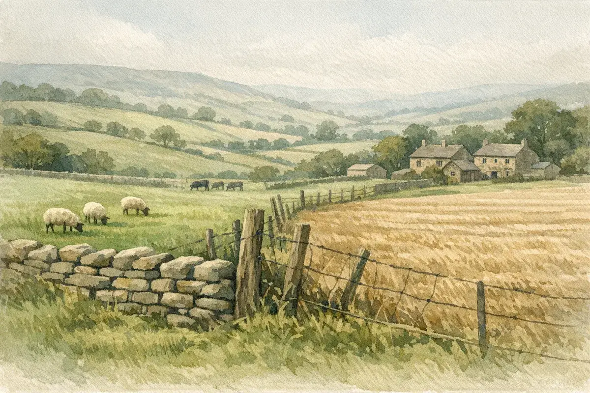
Boundary rows are meant to be boring. A line on a plan, a hedge you trim once a year, a ditch you clear when it's convenient.
But on farmland, boundaries have a habit of becoming emotional and expensive, fast. One moved fence post can turn into an argument about who's responsible for a watercourse, whether a track is shared, or whether that "bit of ground we've always farmed" has quietly become someone else's. And because rural land is often bought, sold and managed across generations, the real fuel isn't usually malice, it's memory, habit, and paperwork that doesn't quite match the ground.
This guide is written for UK farmers, landowners and rural buyers who want a practical route through agricultural land boundary disputes: why they happen, what evidence carries weight, and how you can resolve issues without handing control (and money) to a court.
Why Boundary Disputes Happen On Farmland (And Why They Escalate)
Most agricultural land boundary disputes start with something small and physical, then escalate because nobody can easily prove what was agreed, when, and by whom.
Unlike urban gardens, farmland boundaries often run for hundreds of metres across awkward terrain, through woodland edges, alongside ditches, or over hill ground where the "line" is a series of clues rather than a crisp feature. Add machinery, contractors, stewardship rules and tight margins, and you've got the perfect conditions for drift.
Common Flashpoints: Fences, Hedges, Ditches, Tracks, And Watercourses
A few repeat offenders turn up again and again:
- Fences that creep: A replacement fence goes in "roughly where the old one was", except the old one wasn't straight, and the new one is. Half a metre here, a metre there, it adds up.
- Hedges and banks: Is the boundary the hedge centreline, the hedge base, the bank crest, or the ditch edge? Different areas have different traditions, and tradition isn't the same as title.
- Ditches and watercourses: Who owns to the near bank, to the centre, or to the far bank? Who maintains it? Who's liable if it floods?
- Tracks and gateways: A farm track might look like a boundary, or it might be a right of way, or a private easement, or simply permissive use that's been tolerated for years.
- Rivers and streams that move: Natural changes can shift the practical edge of a field, and neighbours may disagree on what that means for ownership.
Rural Realities: Long Memories, Informal Agreements, And Contractor Drift
On farms, plenty of boundaries are managed on "what we've always done" rather than what the Land Registry plan shows.
- Handshakes outlive paperwork: A previous owner may have agreed a swap, "you farm that triangle: I'll take the headland", and then nobody wrote it down.
- Contractors work to what they can see: Spraying, drilling and fencing contractors follow markers, old posts, or GPS lines that might be based on outdated maps.
- Family and estate history complicates things: Where land has been split, sold off in lots, or kept under long tenancies, the story of the boundary can become more influential than the legal position.
Once a neighbour feels you've taken ground (or accused them of taking yours), positions harden. That's why your best move is to get factual quickly, before the dispute becomes a point of principle.
Start With The Paper Trail: What Your Title Actually Shows
If you do one thing early, do this: assemble the paperwork properly. It's amazing how many rural boundary rows are argued on half-remembered assumptions, when the relevant transfer plan is sitting in a solicitor's archive, or can be ordered in minutes.
A good starting point is understanding what the register and plan can (and can't) prove. If you're unsure how registration works for rural parcels, it's worth reading up on how agricultural land registration works in the UK because the basics (title numbers, plans, rights and burdens) shape everything that follows.
Title Plans Vs The Boundary On The Ground: The General Boundaries Rule
In England and Wales, most title plans are based on Ordnance Survey mapping and show general boundaries, not precise surveyed lines. In plain English: the red edging is a guide, not a guarantee to the centimetre.
That doesn't make the plan useless, it's often the backbone of the case, but it explains why a fence line and a red line can disagree without anyone "being wrong" yet.
Practical implications:
- A title plan will rarely settle whether the line is this side of a hedge or the other side.
- Small-scale plans can't show the detail you need where boundaries run through wide hedgebanks or double ditches.
- Features on the ground may have changed since the base map was created.
If you're in Scotland, the land registration system is different in detail, but the same principle applies: the registered title is critical, and precision depends on what's been mapped and warranted in your deeds.
Key Documents To Check: Transfers, Deeds, Conveyance Plans, And Overage Clauses
The register and title plan are only the headline. The detail is often in:
- Transfers and conveyances (especially older ones) with scaled plans, written boundary descriptions, or "T-marks" showing responsibility for boundary structures.
- Deeds of grant/reservation for rights, including drainage, access, services, and sporting rights.
- Plans attached to options, promotion agreements, or overage: even if you're not developing, an overage clause can make people hypersensitive to a sliver of land near a settlement edge.
- Tenancy documents if the land is let: the landlord and tenant may each have assumed the other is responsible for maintaining a hedge or fence.
When you're pulling documents, don't ignore the "boring" bits. A single sentence in an old transfer can be worth more than ten conversations that begin with "my dad always said…".
If you want a focused explainer on what's typically in the paperwork (and what's often missing), AgLand's guide to checking an agricultural land title deed is a useful companion.
HM Land Registry Tools You Can Use (And Their Limits)
You can usually obtain key documents directly from HM Land Registry in England and Wales:
- Title register (ownership, restrictive covenants, easements).
- Title plan (general boundary).
- Filed plans and certain deed copies where they're referenced.
But there are limits:
- Some older deeds may not be filed, or may be hard to interpret.
- Registration doesn't always capture every historical nuance, especially where land has been in the same ownership for decades.
- A title plan rarely shows the "why" behind a line.
For deeper context on what you can (realistically) pull and interpret from the registry, see our overview on Land Registry records for agricultural land.
Read The Ground Like A Surveyor: Evidence That Carries Weight
Once you've gathered the paper trail, you need to look at the land with a slightly different mindset: not "where do we work it?", but "what would an independent expert treat as reliable boundary evidence?".
The strongest cases usually combine documents with physical and historic features that make sense of those documents.
Physical Indicators: Hedgerow Lines, Banks, Ditches, And Old Fence Footings
Walk the line slowly. Take someone calm with you. You're looking for continuity and intent.
- Hedgebanks: Old banks often indicate deliberate boundary formation. The "ownership line" may relate to the bank, not the current hedge growth.
- Ditches: Traditionally, a ditch and bank were created together: in some areas the ditch can sit on one side of the legal boundary. Don't assume the boundary is the centre of the ditch.
- Old fence footings: Rotten posts, wire remnants, strained lines in mature hedges, these can show where an earlier fence ran.
- Changes in land use: A clear "edge" where cultivation stops and rough ground begins can be historic evidence of a boundary… or just practical farming.
Treat your own observations as preliminary. In a dispute, it's not the opinion that matters, it's the quality of the evidence you can present.
Historic Evidence: Aerial Photos, Estate Maps, Ordnance Survey, And Farm Records
If you want to calm a boundary dispute quickly, nothing does it like a timeline.
Useful sources include:
- Historic aerial imagery (multiple years) showing hedge lines, tracks, field shapes and when features moved.
- Estate plans and sale particulars from earlier transactions.
- Ordnance Survey mapping: not definitive for legal boundaries, but helpful to show long-standing features.
- Farm records: cropping maps, stewardship plans, drainage scheme drawings, or even dated photos taken during hedge laying.
Build a simple bundle: "what we have now" plus "what it looked like in 2000/1990/1970" and the key deed plan. You're aiming to show the dispute isn't just your word against theirs.
Rights That Get Mixed Up With Boundaries: Access, Easements, And Prescriptive Use
A lot of rural boundary arguments are actually about rights.
- You may accept the boundary but dispute a neighbour's right to cross.
- Or you may agree access exists but argue about where the track runs.
- Or a neighbour may claim they've used a route "for years" and believe that gives them ownership.
This is where terminology matters. Ownership of the soil and a legal right over it are different things, and mixing them up can send negotiations off the rails.
If access, services, drainage or shared tracks are part of the row, it's worth getting your head around rural rights and obligations, our explainer on agricultural land easements is a solid starting point before you start drafting letters or paying for expert reports.
The UK Legal Routes: From Agreement To Determination
Most boundary disputes never need a judge. But you do need to know what the legal "end points" look like, because the possibility of formal determination is often what brings a neighbour to the table.
Broadly, you've got a spectrum:
- Informal agreement (supported by evidence)
- Written boundary agreement / deed
- Determined boundary application (where appropriate)
- Court proceedings (usually the last resort)
Boundary Agreements, Deeds Of Rectification, And When They Work
If you and your neighbour can agree the line, you can record it properly.
- A boundary agreement can document what you both accept as the boundary, often supported by a plan.
- A deed of rectification may be relevant where a conveyancing error has created a mismatch between intent and what was written.
These routes are attractive because they're usually:
- quicker than litigation,
- cheaper than litigation,
- and far more neighbour-friendly.
The catch: they need careful drafting and a plan that actually shows what's agreed. A vague sketch that can't be related to features on the ground stores up another dispute for the next owner.
Determined Boundaries: When Precision Matters And How The Process Runs
Where the exact line genuinely matters (think: development value, access pinch points, ransom strips, stewardship margins), you may consider a determined boundary.
In England and Wales, this involves submitting a detailed plan and evidence so the boundary can be recorded with greater precision than a general boundary.
In practice, it tends to require:
- a high-quality measured plan (usually prepared by a competent surveyor),
- supporting evidence (deeds, historic plans, physical features),
- and a willingness to handle objections.
It's not something you do lightly: it's something you do when ambiguity is costing you, or will cost you in a sale.
Adverse Possession And "Encroachment": What Counts In Rural Settings
You'll hear "adverse possession" mentioned whenever someone has farmed a strip of land for a long time. But it's not a magic wand.
What matters is the legal test (and the land's registration status), plus the facts: possession, intention, and how the occupation has been treated over time.
Typical rural scenarios include:
- A neighbour has enclosed and grazed a corner for years.
- A hedge has been maintained as if it's the boundary, even though the paper suggests otherwise.
- A track or verge has been used exclusively by one party.
These cases are fact-sensitive and can be contentious. If you think adverse possession is in play, either as a risk to you, or a potential claim, read our dedicated guide on adverse possession of agricultural land and then take proper advice before you fire off accusations.
A Step-By-Step Strategy To Resolve A Boundary Dispute Without Court
The best outcome is boring: an agreed line, a signed plan, everyone gets back to work.
The second-best outcome is still fairly boring: you narrow the disagreement to one short section, decide what you can live with, and keep the peace.
Here's a practical process that tends to work on farms because it respects reality, busy people, long history, and the need to keep access open.
How To Raise It With A Neighbour: Tone, Timing, And A Clear Ask
Before you do anything formal:
- Pick your moment. Don't start the conversation while stock are being moved or in the middle of harvest pressure.
- Start with a question, not an accusation. "Can we look at this boundary together? I think our plans might not match the fence." lands better than "You've taken my land."
- Bring one or two pieces of evidence (a plan extract, a dated photo), not a lever-arch file.
- Make a clear ask. For example: "Can we agree to pause any works here until we've had a surveyor mark the line?"
If the relationship is already strained, put the request in writing early, politely, and without threats. The aim is to stop further changes while you work out the facts.
Commissioning A Measured Survey: Setting The Brief And Avoiding Wasted Fees
Measured surveys can save you thousands by turning a messy argument into something measurable. They can also waste money if the brief is sloppy.
A sensible survey brief should:
- identify the exact boundary length in dispute,
- list the documents you want the surveyor to consider (title plan, deed plans, any old estate map),
- specify what deliverable you need (e.g., a plan suitable for agreement and potential Land Registry use),
- and confirm how features will be related to the mapping base.
If you're not sure what type of survey is appropriate, and when it's overkill, our guidance on agricultural land survey requirements will help you ask the right questions before you commission work.
Mediation And Expert Determination: Cost, Confidentiality, And Typical Outcomes
When two sensible parties can't bridge the gap, a neutral third party often can.
- Mediation is typically confidential and designed to reach a compromise. It's especially useful where the dispute is as much about relationships and practicalities as it is about the legal line.
- Expert determination can work well when the issue is technical (where is the line?) and both sides agree to be bound by an expert's decision.
In real life, these routes often produce outcomes like:
- agreeing a line with a small land swap,
- granting a formal access right so the boundary can be fixed,
- or agreeing who maintains which side of a hedge/ditch going forward.
And yes, it can feel frustrating to "give" something when you think you're right. But measured against legal spend and lost time, a pragmatic settlement is sometimes the most commercial farming decision you'll make all year.
When It Turns Contentious: Injunctions, Trespass, And Costs Risk
Sometimes you don't get the luxury of a calm process, because someone acts first. A fence is moved, a hedge is ripped, a ditch is dug, a gateway is blocked.
At that point, you're not just discussing a boundary. You're managing risk: loss of control over the land, potential damage, and the very real chance that costs spiral.
What To Do If Someone Moves A Fence Or Digs Out A Hedge
If you think the boundary has been altered or you're facing immediate harm:
- Document immediately: dated photos, videos, measurements to fixed points, and notes of who was present.
- Avoid self-help escalation: moving the fence back in anger can turn a civil dispute into something uglier (and can undermine your position).
- Put them on notice in writing: a calm letter/email stating what happened, what you believe, and requesting a pause pending professional input.
- Preserve evidence of the "before": older photos, contractor invoices, stewardship records, any prior fencing quotes.
If hedges are involved, remember there may be additional legal and scheme constraints around removal and works, including the Hedgerows Regulations 1997. Don't inadvertently create a separate compliance problem while trying to fix a boundary problem.
Involving Solicitors, Land Agents, And Chartered Surveyors: Who Does What
Contentious boundary disputes are one of those areas where the right team saves time.
- A chartered surveyor (often with rural boundary experience) helps establish the likely line using evidence, mapping and measured work.
- A land agent may help negotiate pragmatically, particularly where access, farming operations or tenancy issues overlap.
- A solicitor handles the legal position, correspondence, and any formal steps.
Choosing the right legal adviser matters because rural titles often include rights, reservations and historic quirks that general property work doesn't always cover. If you're weighing up professional support, start with this guide on what an agricultural land solicitor actually does.
Managing Evidence And Communications For A Potential Claim
If the dispute looks like it may end up formal, assume everything you write could be read back later.
A few practical rules:
- Keep a single folder of: plans, photos, emails, notes of meetings, and invoices.
- Write like a professional even if you're furious. Avoid sarcasm and accusations.
- Stick to facts: dates, measurements, what was done.
- Don't trespass to "get a better photo". Stay on your side unless you have clear permission.
Courts (and mediators) are persuaded by credibility. Calm, consistent, evidenced communication makes you credible, and it often encourages settlement because the other side can see you're organised.
Buying, Selling, Or Letting Land With Boundary Uncertainty
Boundary uncertainty doesn't just cause arguments, it affects value, mortgageability, lettings, and the smooth running of a sale. And it nearly always surfaces at the worst moment: when you've accepted an offer, agreed a rent, or need a lender's sign-off.
Due Diligence Checks Before You Offer Or Accept: Red Flags And Questions
If you're buying (or taking on a farm business tenancy, grazing licence or contract farming arrangement), assume boundaries are your problem the day you complete.
Red flags worth probing:
- The seller says "the fence isn't quite in the right place but it's always been like that."
- A track is used by multiple parties but there's no clear paperwork.
- The plan looks vague where the land narrows or meets a road.
- There are fresh fences or freshly cut hedge lines near a boundary.
- A neighbour is actively farming up to a line that doesn't match the plan.
Ask direct questions early:
- Has there been any dispute, complaint, or discussion with neighbours?
- Who maintains which boundaries and watercourses?
- Are there any informal agreements (and can they be written down)?
If you're buying in England specifically and want a wider checklist that ties boundaries into the rest of rural due diligence (access, schemes, tenancies), our guide to buying and managing agricultural land in England is worth having alongside your agent's particulars.
Disclosures, Contract Wording, And Indemnity Insurance In Practice
If you're selling, boundary issues must be handled carefully.
- Disclose disputes honestly. Trying to bury a known issue often backfires during enquiries or after completion.
- Use precise contract wording where boundaries are uncertain, and agree what evidence is relied upon.
- Indemnity insurance can sometimes help where the risk is defined and there's no ongoing confrontation, but it's not a cure-all, and it usually won't help if you've already stirred the pot with formal allegations.
This is where good professional advice pays for itself: you want to protect the transaction without storing up a misrepresentation claim.
Tenancies, Cropping Licences, And Who Controls Boundary Maintenance
If land is let, ask: who is responsible for boundary maintenance, and who controls the "line" in practice?
- A tenant may have maintained (and effectively fixed) a boundary position for years.
- A landlord may be responsible for structural boundary features under the tenancy terms.
- Short-term licences can lead to sloppy boundary management, because nobody feels long-term accountability.
If you're a landlord, it's usually sensible to set expectations in writing: what can be repaired like-for-like, what needs consent, and how any re-fencing should be set out and recorded. It's far cheaper to prevent drift than to litigate it later.
Preventing Future Disputes: Practical Boundary Management On Farms
The most cost-effective boundary dispute is the one that never happens.
You don't need to turn your farm into a surveying project, but you do need a repeatable routine, especially if you use contractors, you've got multiple lets, or you're in stewardship schemes where margins and options rely on the right line.
Marking And Maintaining Boundaries: GPS, Mapping, And Physical Works
A few practical habits make a big difference:
- Walk boundary lines annually (or at least the high-risk ones: near roads, tracks, development edges, and watercourses).
- Use consistent reference points: gateposts, culverts, mature trees, fixed corners.
- Record GPS lines carefully: GPS is great operationally, but don't treat a tractor screen as a legal boundary. Use it to spot drift and trigger checks.
- When re-fencing, set out first: agree a line, mark it, and photograph it before posts go in.
If you're doing significant works, consider asking a surveyor to set out corners or provide a plan. That upfront spend can prevent a five-figure argument later.
Recording Agreements And Works: Photos, Plans, And Signed Notes That Stand Up Later
Your future self (or the next owner) will thank you for a simple evidence habit:
- Take dated photos before and after any boundary works.
- Save quotes and invoices that describe what was done and where.
- Keep a one-page note of any agreement with a neighbour, signed and dated by both of you.
- Store plans in a single place, digitally as well as in a folder.
You're not trying to create legal theatre. You're creating clarity.
Working Around Stewardship, Hedgerow Rules, Rights Of Way, And Designations
Boundary management isn't only about neighbours.
- Stewardship and land management schemes can impose rules about hedgerow cutting dates, buffer strips, and maintenance.
- Public rights of way running alongside a boundary introduce extra sensitivities (and often, extra witnesses).
- Designations (SSSIs, AONBs, scheduled monuments) can constrain what "simple works" actually means in practice.
Before you grub out a hedge, widen a track, or re-grade a bank, check what applies to your holding and get the right consents where needed. Many boundary disputes escalate because someone acted quickly and unintentionally triggered a compliance issue.
One final, practical tip we've seen work well: if you're agreeing a boundary line, agree the maintenance responsibility at the same time. Settling the line but leaving "who trims and who pays" vague is a reliable way to reopen the argument in two seasons' time.
Conclusion
Agricultural land boundary disputes are rarely just about metres on a map. They're about access, pride, future value, scheme compliance, and whether you can get on with your neighbour next week.
If you take anything from this guide, make it this: get the paper trail together early, treat the ground as evidence (not assumption), and move quickly towards an agreed, recorded outcome. The longer uncertainty sits, the more it hardens into "truth" in people's minds.
When you're buying, selling or reorganising land, build boundaries into your due diligence rather than treating them as an afterthought. And if a disagreement is brewing, don't wait for a fence to move, pause the works, document what's there, and bring in the right professionals to keep it proportionate.
Disclaimer: AgLand.co.uk is a UK agricultural land and rural property matching service, where buyers register what they are looking for and owners advertise directly to the buyers who match, and a rural resource hub. Nothing in this text is intended as legal, financial, or investment advice. You should carry out your own due diligence and seek guidance from appropriately qualified professionals (for example, solicitors, chartered surveyors, land agents and tax advisers) before acting on any information here.