
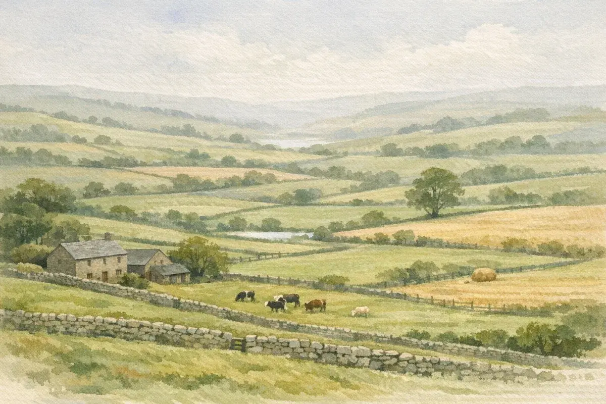
If you've ever looked at a rural listing and thought "good land" meant "good everywhere", you're not alone. In the UK, land quality is usually talked about through the Agricultural Land Classification (ALC) system, those familiar Grade 1 to Grade 5 labels. But the reality is messier (and more useful) than a single number on a map.
The land grading system UK professionals rely on is really a way of describing limitations: how often the soil is too wet, how drought-prone it is, how steep it is, how workable it is in a normal season, and what that means for cropping and grass. That's why ALC influences everything from what you can sensibly grow, to how planners weigh development, to how buyers and tenants judge risk.
This guide cuts through what the grades actually mean in practice, how grading is evidenced in the UK, and how you can use it, sensibly, when you're farming, buying, selling, letting, or assessing a planning proposal.
What The UK Land Grading System Actually Measures (And What It Doesn’t)
When people say "land grade", they often assume it's a direct proxy for yield or profit. It isn't, at least not on its own. ALC is a capability-based classification: it asks what the land can reliably do for agriculture under typical management, given its natural constraints.
Agricultural Land Classification (ALC) Explained: Grades 1–5
In England and Wales, ALC groups land into five grades (with Grade 3 split into 3a and 3b):
- Grade 1 (Excellent): very wide crop range, minimal limitations.
- Grade 2 (Very good): wide crop range, minor limitations.
- Grade 3a (Good): capable, but notable limitations that reduce cropping flexibility or consistency.
- Grade 3b (Moderate): more restricted: typically fewer arable options and/or less reliable output.
- Grade 4 (Poor): severe limitations: usually grass-based or limited arable in the right years.
- Grade 5 (Very poor): very severe limitations: generally rough grazing, moorland, or extensive uses.
If you want the formal definitions and the practical interpretation in a single place, AgLand's explainer on how agricultural land classification works in the UK is a solid reference point.
Climate, Soil, And Site Factors That Determine A Grade
ALC grade is driven by a combination of interacting factors. The same soil series can perform very differently depending on where it sits in the landscape.
Key determinants include:
- Climate: accumulated temperature (growing season warmth) and rainfall patterns. Cooler, wetter uplands get constrained quickly.
- Soil wetness: how long the soil stays at or near saturation, influenced by drainage, permeability, groundwater, and landscape position.
- Droughtiness: the soil's ability to store plant-available water (especially relevant on light/sandy soils in drier parts of England).
- Slope and relief: steepness affects machinery safety, erosion risk, and workability windows.
- Soil depth and stoniness: shallow or stony profiles limit rooting and cultivation.
- Flooding risk: frequency and duration of flooding can cap capability even if the soil is otherwise decent.
What ALC doesn't measure directly:
- your nutrient management, variety choice, drainage investment, or timeliness
- your business model (high-value veg vs. livestock vs. contracting)
- field access, distances, or operational efficiency
- stewardship income or natural capital value
So yes, two Grade 3 fields can be worlds apart in profitability if one is in neat blocks beside the yard with good gateways, and the other is fragmented with poor access and awkward headlands.
Why "Best And Most Versatile" (BMV) Land Matters
"BMV land" is planning shorthand for Grades 1, 2, and 3a. It's treated as a finite national resource because it offers the greatest flexibility for food production.
In practical terms, BMV matters because it changes the tone of planning conversations. If land is evidenced as BMV, planning authorities often expect:
- stronger justification for why that site is needed
- more effort to avoid, reduce, or mitigate loss of high-quality soils
- clearer evidence (not just a screenshot of a provisional map)
That said, BMV doesn't make development impossible: it raises the bar for evidence and design. Think of it as a planning "weighting", not a veto.
Grades 1–5 In Practice: Typical Uses, Constraints, And Real-World Expectations
You can read grade descriptions all day and still be surprised when you actually farm the land. The most helpful way to think about ALC is: how often will this land let you do the job at the right time?
Grades 1–2: High Versatility And High Sensitivity
Grades 1–2 typically support a wide range of crops and rotations with relatively consistent performance. You'll often see:
- higher-value arable and horticultural enterprises
- better workability windows (though not always, some very good land is also very "honest" about showing compaction)
- greater sensitivity to soil structure damage because the land is worth protecting
Grade 1 is rare in UK terms and tends to cluster in areas with the right combination of soil and climate (for example parts of the Fens and certain lowland pockets). If you're weighing up a purchase, it's worth reading a dedicated overview of what Grade 1 agricultural land in the UK typically looks like, because the label is sometimes used a bit casually in marketing.
The commercial point: this is where expectations (and sometimes tempers) run higher. On genuinely top-quality land, a single poor trafficking decision can cost you more than you saved by "getting on when it was nearly right".
Grade 3: The 3a Vs 3b Split And Why It Changes Outcomes
Grade 3 is the UK's great "middle band", and it's also where people get caught out. 3a is BMV: 3b isn't. That one split can change:
- how planners weigh soil loss
- whether a developer needs more rigorous alternatives testing
- how buyers interpret long-term versatility
From a farming point of view, the split often reflects whether limitations are occasional/manageable (3a) or frequent/significant (3b): wetness, droughtiness, slope, or a mix.
If you're trying to sense-check an agent's description or your own desktop research, AgLand's guide to the difference between Grade 2 and Grade 3 land is useful because it gets into the practical "what changes on the ground" detail, not just the definitions.
Grades 4–5: Severe Limitations, But Not "Worthless"
Lower grades often get dismissed as "marginal". That's a mistake, especially now, when environmental payments, carbon outcomes, and diversified rural income are part of real-world decision making.
What you can reasonably expect:
- Grade 4: typically grass-based systems, forage crops in good years, and selective arable where the limitation is more seasonal than permanent.
- Grade 5: very constrained land, often exposed, wet, shallow, steep, or otherwise limited, best suited to extensive grazing, habitat, peatland, or woodland objectives.
If you're evaluating rougher ground for a purchase or tenancy, don't stop at the label. Look at practical uses, rights, and constraints. A focused read on realistic Grade 5 agricultural land uses can help you separate "hard to farm" from "still strategically valuable".
One more reality check: Grade 4–5 land can be the most expensive land you ever misjudge if access is poor, maintenance liabilities are high, or you inherit unmanaged water and boundary issues.
How Land Is Graded In The UK: Surveys, Mapping, And Evidence Standards
A surprising amount of ALC argument comes down to one thing: are you looking at a provisional map, or actual site evidence? In UK transactions and planning, that distinction matters.
Provisional ALC Maps Vs Site-Specific Surveys
Most people first encounter ALC through mapping layers. These are helpful for a first-pass view, but they're not gospel.
- Provisional maps were often produced at broader scales and can miss field-by-field variation.
- Soil patterns can change within a single parcel due to historic drainage, alluvial deposits, or subtle shifts in topography.
- Some mapping is essentially "best available" interpretation rather than ground-truthed classification.
Use provisional ALC as a screening tool, not a decision tool.
What A Proper ALC Survey Involves (Pits, Sampling, And Wetness Assessments)
A proper ALC survey (for planning or robust due diligence) is closer to an investigation than a desktop exercise. Expect:
- Soil pits/auger borings across representative areas (not just the "good bit")
- Soil profile descriptions: texture, structure, stoniness, depth, mottling, rooting
- Wetness assessment: considering drainage class and indicators of waterlogging
- Topography and limitation mapping: slope, micro-relief, field variability
- Climate data integration: to calibrate wetness/droughtiness and crop suitability
Timing matters. A visit in a dry spell can still evidence wetness (through profile features), but some issues are easier to interpret with seasonal context.
Who Can Produce ALC Evidence And What Planning Teams Expect
For anything contentious, development proposals, land promotion, major infrastructure, planning teams generally expect ALC evidence to be prepared by suitably qualified practitioners with demonstrable experience.
In practice, that means:
- clear methodology aligned to recognised ALC guidance
- transparent sampling strategy and mapping
- conclusions that follow from evidence (and acknowledge uncertainty)
If you're commissioning work, ask who will sign it off, what similar jobs they've done locally, and what the output will look like (plan scales, pit logs, limitation maps). Cheap evidence that doesn't stand up to scrutiny is rarely cheap in the end.
Land Grading And Planning: When ALC Drives Decisions (And When It Doesn’t)
ALC shows up in planning because local authorities are expected to consider soil as a resource, especially where BMV land is involved. But it's not the only material consideration, and it doesn't automatically outweigh everything else.
The Planning Policy Hook: Protecting BMV Land
Where Grades 1, 2, and 3a are affected, planning authorities often look for a clear narrative:
- Is there a sequential approach (using lower-grade land where feasible)?
- Have alternatives been considered?
- Can the scheme avoid the best soils on site?
Even if you're not developing, this matters when land is being promoted around you. Knowing whether your fields are likely to be argued as BMV can inform your negotiating position and your appetite for professional representation.
Common Triggers: Housing Allocations, Solar, Minerals, And Infrastructure
In UK practice, ALC comes to the fore when land use is changing in a way that removes agricultural capability for the long term.
Typical triggers include:
- Housing and employment allocations: especially on edge-of-settlement blocks of flatter land.
- Solar farms: often pitched as reversible, but still scrutinised for soil impacts and cumulative loss of BMV.
- Minerals and quarrying: soil stripping, storage, and restoration plans become central.
- Roads, rail, grid infrastructure: linear schemes can cut across multiple grades and holdings.
If you're comparing how all this affects values, it helps to anchor the discussion in real market context. The wider picture in UK agricultural land prices and what's driving them into 2026 can help you think about grade alongside location, competition, and non-farming demand.
Mitigation, Design, And Offsetting: How Applicants Address ALC Impacts
Where high-quality soils are at stake, applicants commonly propose:
- Avoidance: re-siting infrastructure, moving access tracks, clustering built form.
- Minimisation: reducing footprint, using previously developed land, careful construction methods.
- Soil management plans: stripping, handling, and storage specifications to avoid compaction and mixing.
- Restoration: particularly for minerals, where soil profiles may be reconstructed.
A useful way to read mitigation is to ask: does it protect the soil in the field, or only on paper? Soil handling is one of those topics where method statements can be technically excellent and still fail because the site team is under time pressure.
Land Grade, Productivity, And Farm Business Strategy
Land grade is a starting point for decisions, not the decision. The sharper approach is to treat ALC as a constraint map, and then build a system that makes money within those constraints.
Matching Enterprises To Land Capability (Arable, Grass, Mixed, Horticulture)
A practical way to think about enterprise fit:
- Grade 1–2: supports higher-value rotations, veg, potatoes, sugar beet, combinable crops, subject to local climate and water. But it often demands more careful traffic management.
- Grade 3a: commonly strong mixed/arable ground: might suit flexible rotations and resilience-focused cropping (cover crops, diverse break crops).
- Grade 3b–4: often better suited to grass, forage, and robust arable choices where timeliness is the key risk.
- Grade 5: extensive grazing, habitat creation, woodland, peatland restoration, plus diversified income where appropriate.
The business question isn't "is it Grade 3?" but "what's the limiting factor, wetness, drought, slope, and how does that hit my margins?"
Improving Performance Without "Changing The Grade" (Drainage, Organic Matter, Compaction)
You can often improve output and reliability without expecting the official grade to shift.
What tends to pay back, depending on the limitation:
- Drainage maintenance (and in some cases renewal): clearing outfalls, sorting broken laterals, managing ditch levels.
- Soil structure work: controlled traffic, sensible axle loads, avoiding cultivation when the soil's telling you "not today".
- Organic matter building: cover crops, manures, composts (with nutrient compliance), and better residue management.
- pH correction: boring advice, but it still wins.
If your land is grass-based (or you're considering moving in that direction), the fastest gains usually come from basics done well: measuring covers, fixing pH, and getting grazing pressure right. AgLand's guide to practical pasture land management in the UK goes into the kind of improvements that show up in carrying capacity, not just soil test results.
Environmental Schemes And Natural Capital: How Lower Grades Can Still Stack Up
Lower-grade land is often where environmental outcomes are easier to deliver (and easier to evidence): wet features, species-rich grassland restoration potential, upland habitats, riparian buffers.
That doesn't mean you should "give up" on production. It means you can be more strategic:
- Put your best effort into the fields that reliably respond.
- Use constrained fields for outcomes that don't depend on perfect workability windows.
- Consider how public goods payments, biodiversity uplift, and long-term resilience fit your whole-farm plan.
The trick is integration, designing a system where environmental income complements (rather than competes with) the core enterprise.
Buying, Selling, Or Letting: How To Use Land Grade In Due Diligence And Valuation
ALC affects value, but rarely in a neat, linear way. In the real UK market, land grade interacts with location, block size, access, scheme income, and who's bidding.
What To Check In A Particular Field: Soil Type, Drainage, Access, And Past Cropping
If you're assessing a specific parcel, your best insights often come from a structured field-by-field check:
- Soil type and depth: dig, don't guess. Even a spade and a quick texture feel test tells you plenty.
- Drainage reality: look for old outfalls, silted ditches, patched areas, and where water sits after rain.
- Compaction and structure: headlands, gateways, and tramlines reveal how forgiving the land is.
- Access and gateways: width, visibility, turning, HGV practicality (especially if you'll move kit between blocks).
- Cropping history: what has actually grown well here, and what's been quietly abandoned?
For buyers in England who want the bigger checklist, tenure, planning risk, stewardship, services, AgLand's practical guide to agricultural land in England is a good companion read.
How Grade Interacts With Tenancies, Cropping Clauses, And Rent
On lettings, grade is often less important than capability under the tenancy terms.
Watch for:
- Cropping clauses that don't fit the land's workability windows (recipe for disputes).
- Repairing obligations around drains, ditches, and tracks.
- Reseeding/grassland management expectations on heavier or wetter soils.
- Flexibility for stewardship options (and who retains scheme income/obligations).
Rent tends to reflect reliability and competition as much as grade. A convenient, well-shaped Grade 3a block near a livestock hub can out-rent a more distant Grade 2 parcel with awkward access.
Red Flags: Misdescribed Land, Over-Reliance On Desktop Data, And Boundary Mismatches
A few issues we see come up again and again:
- "Grade 1" as a sales phrase without evidence. True Grade 1 is scarce: challenge it politely and ask what it's based on.
- Desktop ALC presented as definitive. Treat it as indicative until supported by site work.
- Boundary mismatches between the plan, the fenced line, and what's registered.
- Out-of-date drainage assumptions, a field that "was tile drained" can still be wet if outfalls and mains aren't functional.
Where value is being argued off the back of a grade claim, it's worth grounding the discussion in market reality. For instance, if you're modelling a premium scenario, AgLand's overview of Grade 1 agricultural land prices helps you think about what actually drives the top end (and when "Grade 1" isn't the reason someone pays up).
How To Find And Verify Land Grading Data In The UK
You don't have to guess. In the UK, you can pull together a decent picture of land capability with a mix of public datasets and targeted professional input.
Defra, MAGIC, And Local Authority Evidence: What You Can Pull Yourself
For an initial view, you can:
- check what ALC mapping is available for the area (and note whether it's provisional)
- review local planning documents and evidence bases where major sites have been assessed
- look for scheme documents (where available) that describe soils and land management constraints
MAGIC can be a helpful place to view environmental and landscape constraints alongside soils and land use designations, but treat all map layers with the same caution: scale and data age matter.
Commissioning A Survey: When It's Worth The Cost And How To Brief It
Commission a survey when the grade outcome will materially change a decision, for example:
- you're promoting land for development and BMV is likely to be a key issue
- you're buying a high-value block where the price assumes top capability
- you need robust evidence to resolve a dispute or support an application
Briefing tips that save money (and stress):
- define the decision the survey will support (planning, purchase, tenancy, restoration)
- agree sampling density and how variability will be mapped
- ask for pit logs, limitation mapping, and a clear statement on 3a vs 3b where relevant
Working With Land Agents And Rural Surveyors To Interpret Results
Even with a good report, interpretation is where value is won or lost.
A land agent or rural surveyor with local knowledge can help you translate ALC into:
- realistic cropping and management expectations
- valuation logic (including who the likely buyer/tenant pool is)
- negotiation strategy, what to push on, what to concede, what to evidence
If you're actively searching, the easiest way to keep your decisions disciplined is to compare like with like: similar grades, similar access, similar constraints, similar local demand. On AgLand you register the grade, acreage and area you're after, and you're alerted whenever an owner or agent advertises land that matches, so you're weighing real opportunities rather than relying on guesswork.
Conclusion
Treat the land grading system UK professionals use as a practical lens, not a trophy label. ALC tells you where the land will help you, and where it will fight you, through wet autumns, dry springs, tight harvest windows, and everything in between.
If you take one approach forward, make it this: use provisional mapping to screen, use field observation to sanity-check, and use proper survey evidence when the decision is expensive or contentious. Then build your farming plan, purchase offer, or planning position around the limiting factors, not the headline grade.
Disclaimer: AgLand.co.uk is a UK agricultural land and rural property matching service, where buyers register what they are looking for and owners advertise directly to the buyers who match, and a rural resource hub. Nothing in this text is intended as legal, financial, or investment advice. You should carry out your own due diligence and take advice from appropriately qualified professionals (for example, rural surveyors, agricultural consultants, solicitors, tax advisers, and planning consultants) before making decisions.